Watertable Depth Determination in Rhode Island
Digitizing and interpolating watertable depths for all of Rhode Island
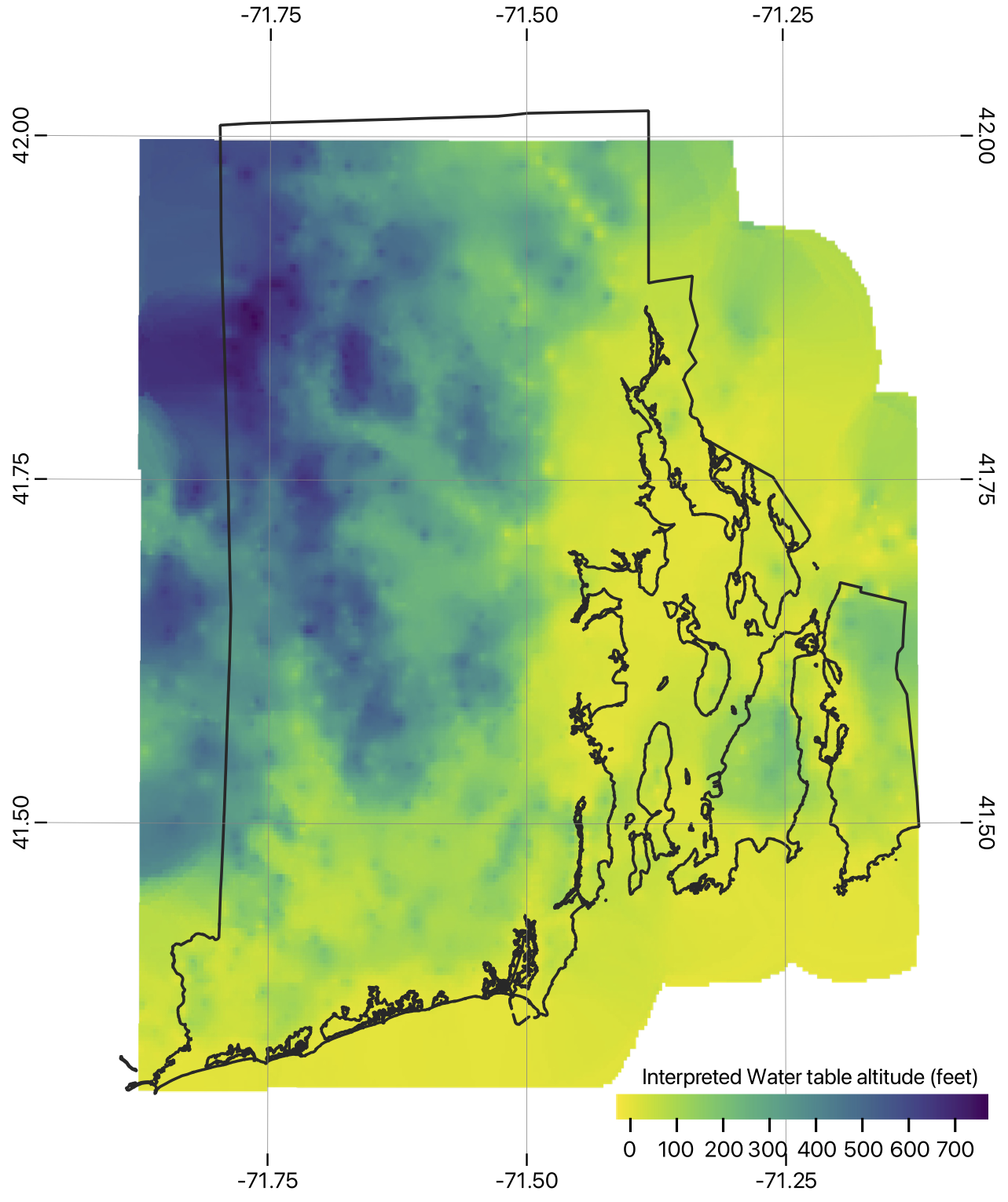
Watertable Altitude Raster
Interpolated surface WGS84 (tiff format, lat/lon, EPSG:4326)
Interpolated surface EPSG:3438 (tiff format)
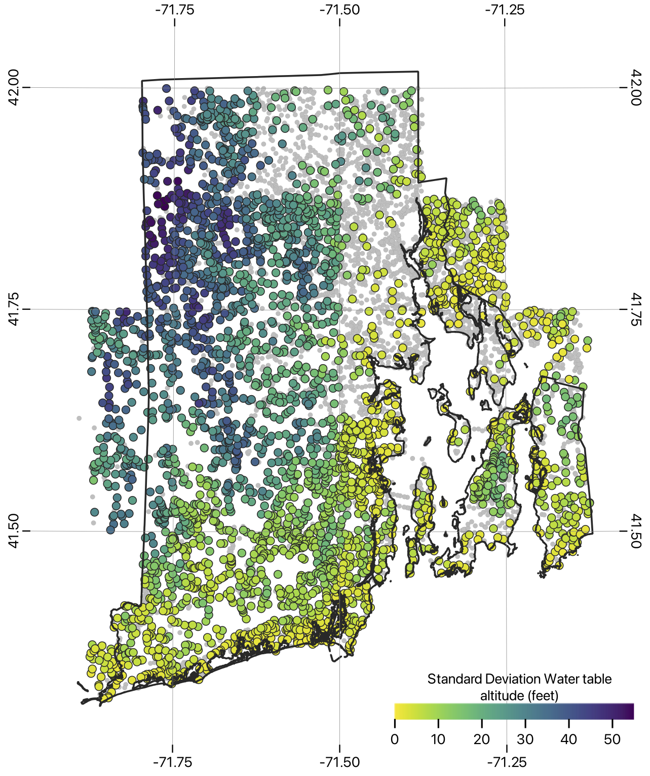
Digitized Watertable Depths
Water table depths EPSG:3438 (geopackage format)
Methodology
Groundwater Surface Estimation in Rhode Island (pdf format, pre-submission, mid 2025)