Saltwater Instrusion Mapping
Identifying locations where saltwater is making the strongest impacts
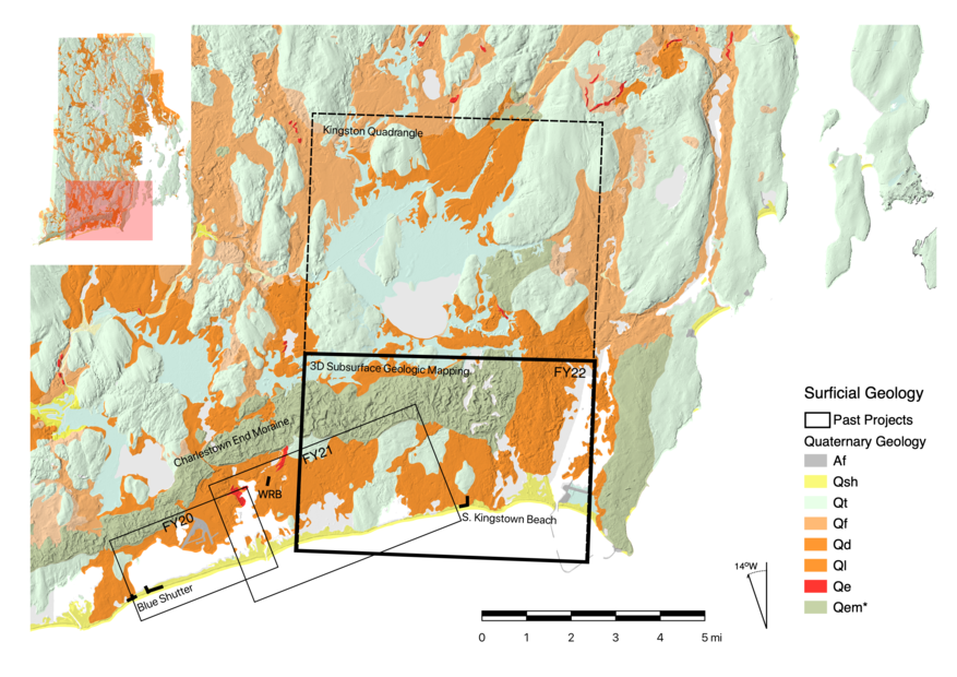
Funding from USGS STATEMAP Grants in FY2021 and FY2022 to map coastal regions of Rhode Island
Ninigret Pond to Trustom Pond
FY2021 (proposed late 2020; funded mid-2021)
Mapping coastal regions between Ninigret Pond and Trustom Pond, south of the Charlestown Moraine.
Deliverables
- Map of Depth to Subsurfaces (pdf format)
- Saltwater / Freshwater Interface
- Watertable
- Bedrock
- Data file with Depth to Subsurface Interfaces (geopackage format)
- Bedrock
- WaterTable
- SaltFreshInterface
- Associated metadata (within the data file)
Subsurface Mapping Strategy
- Electrical Resistivity
- Passive Bedrock Mapping
- Horizontal - Vertical Spectral Ratio
- Well-completion Reports
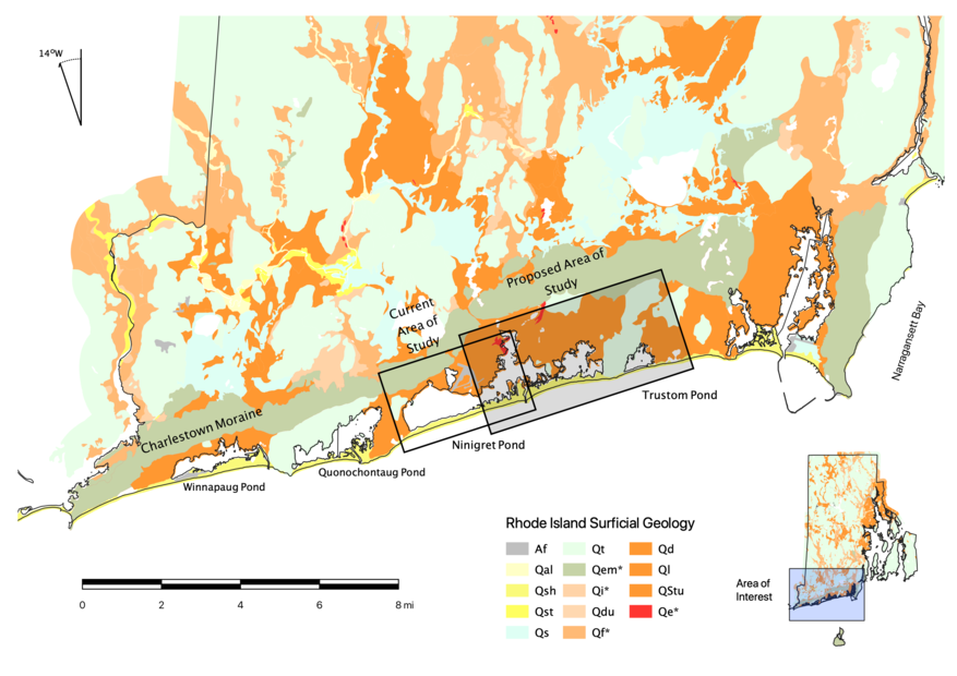
Trustom Pond to Point Judith Pond
FY2022 (proposed late 2021; funded mid-2022)
Mapping coastal regions Trustom Pond and Point Judith Pond, south of the Charlestown Moraine.
Deliverables
- Map of Depth to Subsurfaces (pdf format)
- Saltwater / Freshwater Interface
- Watertable
- Bedrock
- Data file with Depth to Subsurface Interfaces (geopackage format)
- Bedrock
- WaterTable
- SaltFreshInterface
- Associated metadata (within the data file)
Subsurface Mapping Strategy:
- Electrical Resistivity
- Passive Bedrock Mapping
- Horizontal - Vertical Spectral Ratio
- Well-completion Reports